Dairy of a soldier at Promontory

May 11th, 1869


Dear, Father & Mother

I hope this letter find you in good health and that everyone is doing well. I want to write you of my experience at Promontory Summit, Utah. My regiment arrived by train the day before the Great Event as the reporters called it. As most people know the transcontinental railroad is almost done. This is an amazing accomplishment for the United States no longer will people of this great nation have to travel by ship or by wagon to get to California. People are saying in less than four days you can cross the country.

I am seeing first hand how this is possible. Already since leaving Virginia we have made record time and now I find myself in dry aired landscape of Utah. Company K pitched tents and settled for the evening near the railroad track. Our camp is small consisting of a Sibley, two dog tents and couple of other tents for men and gear. We hoisted a flag in camp and even have a portable telegraph box. Tomorrow the president of the Union Pacific, Charles Durrant will arrive. His train has been delayed due to heavy rains. It is peaceful right now and the weather is calm. Tomorrow the rails will be joined by a golden railroad spike and the East and West will have a road made of iron.

The trip so far has been comfortable. The train travels at speeds of 35 miles per hour and it is hard to watch the country side go by as it passes so quickly. By the time one of my men tell me to look at something from the window it has already passed. This evolution in transportation will greatly speed up commerce all over the nation.  The locomotive stops every 25 miles or so to fill with water and more coal. Once we crossed the Mississippi River towns grew smaller and smaller and the wide openness of the prairie stretched on like an ocean.

The men right now are sitting around the fire enjoying themselves and looking forward to California and the new post we will have. People say that California is the land where a man can strike is rich and make something of himself. All I know is that I miss home and you. Another man in our regiment also missies someone close to him. His name is Neal he always says he misses Poly but never talks much about her. She must be very special to him. Well mom my men are calling me over to join them so I will write more later.


May 10th

Hello mother and father,

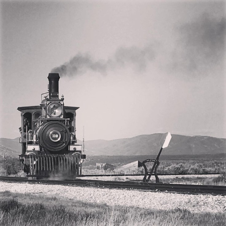
What a day that my company and I had. I have witnessed history here today. We even helped with the festivities during the event by standing guard and help with the flag raising.   Our day started at dawn. Breakfast consisted of oatmeal and cranberries. The Captains wife, Mrs. Clyne is with us on this trip as she is relocating with him so our food as been exceptional. Already at day break reporters were showing up and asking questions of who we are and what we were doing. Of course, our captain was not hesitant to stand up first and make sure the reporter had his name spelled correctly and all his information was indeed correct. He told us “Boys we are making history here today. As we are the first regiment to cross the country by the rail!”59883845_2684807101535478_3787169395583746048_n

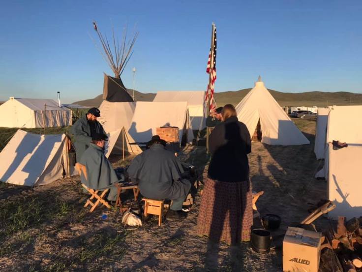
When we marched over to the rails later that morning, already there were hundreds of people swarming the glistening locomotives. The Union Pacific had the 119 a beautiful burgundy painted engine with Johnny Appleseed painted on the sand dome along with lots of shining brass. The Central Pacific arrived with the Jupiter and it is equally magnificent with crimson blue paint and gold inlay on the tender. Both engines were parked nose to nose and before them lay a gap where the last rail would go.60286163_2685363928146462_5214447372335054848_n

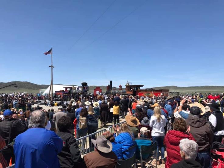
Both the presidents of the railroad companies stood before the rail with Leland Stanford, the president of the Central Pacific holding the pure gold railroad spike and Mr. Durrant with a silver platted Maul. Alongside the track connected to the telegraph wire was a man typing out on his key everything that was taking place during the event. I hope you and all in town were able to crowed into the telegraph office and listen. If only you could have been here, I know you would have enjoyed it. There were a couple of photographers taking photos so maybe Ill be in one or so. They say the photos will go into the newspapers.

We stood for what seemed like hours next to the locomotives and were able to sneak some shots of us in front of the engines while the dignitaries talked. Finally, time had come to complete the railroad and the last rail was laid and spike driven into a special polished railroad tie form California. Everyone cheered and then another railroad tie was put in where the fancy one was and a regular iron spike was driven into that tie completing the railroad. The telegrapher typed out, done and everyone knew that it was over. After seven years of work we have a transcontinental railroad.59911050_2686102968072558_2102391464964128768_n

After the ceremony ended everyone clambered to get a piece of the railroad tie and chipped it away. Soon they will need to lay another. Our captain told us to gather all our stuff up and prepare to board the train again as the westbound is ready to leave. We are the first train to cross over and get to see Promontory fade into the distance as we head west into more desert. It is so dry out here I do hope California will be greener.

Take care, your loving son

60346661_2686098758072979_6527341986217721856_n


~2019

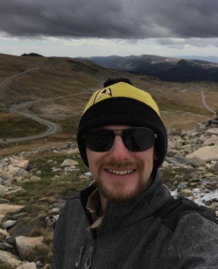
150 years later I was able to take part in the re-enactment ceremony at Promontory Point. The story above is my recollection of the event with a little dreaming in-between.  It was a huge event with well over 10,000 people showing up. I camped with the Ft. Boise Garrison group from Boise who are also good friends of mine and they let me dress and be part of it all. It was fascinating to see how people lived and dress back then, before the age of plastic. The weekend was memorable and almost the same perfect 70 degree weather 150 years later. The event had the president of Union Pacific, Secretary of the Interior, Governor of Utah and leader for Mormon Church. I partaked in not only the ceremony of the 10th but also on the 12th. I want to thank the Ft. Boise Garrsion for loaning of the clothes and also for letting me be apart of history. The driving of the golden spike 150 years ago was the moon landing of the day and 100 years later we went to the moon. I plan to be back in 2069 for the 200th anniversary. Who knows what we will have accomplished by then.60016593_2684807081535480_8579801819255930880_n

Death Valley & the Baby Gauge R.R.

During my recent trip to Las Vegas I decided to take a side trip to Death Valley and hike up to the old Pacific Coast Borax Works railroad line that was nicked named the “Baby Gauge”. The history of the Pacific Coast Borax and their operation just above Death Valley National Park is a fascinating story of mining and tourism.

From Las Vegas, Death Valley is only a two hour drive west. You leave the glittering lights of Vegas behind as you climb up and over Spring Mountain an elevation over 5,000ft. and drop down the west side into the Mojave desert stretching all the way to Pahrump and beyond.IMG_8983 
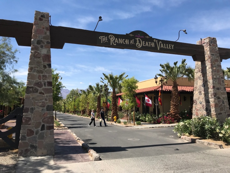
The first and only town really you will go through once leaving Vegas is Pahrump, Nevada. The town reportedly chose the name for Pahrump after the original indigenous name Pah-Rimpi, or “Water Rock,” so named because of the abundant artesian wells in the valley. Because of the artesian wells, the new inhabitants of Pahrump Valley began a number of large ranch-style holdings, mostly over 1000 acres.

The highway passes through town and you eventually make a turn onto a two lane road for Death Valley. The longest part of the drive is over as you glide over a small mountain range to find yourself crossing the California boarder and into the Amargosa Valley. At the jct. with State Route 127 and State Line Road you find Death Valley Junction. At one time this was a happening place.

The town was created in 1907 when the Tonopah and Tidewater Railroad was constructed through the Amargosa Valley and a spur from their main line was built to the Lila C. borax mine in the hills to the west. The town was originally owned by Robert Tubb, who operated a saloon, store, and brothel. 7fd83486380f9bdeb44414d98918d74d 
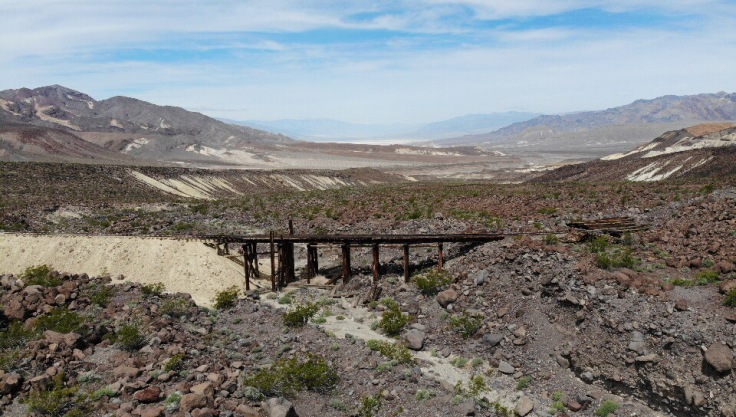
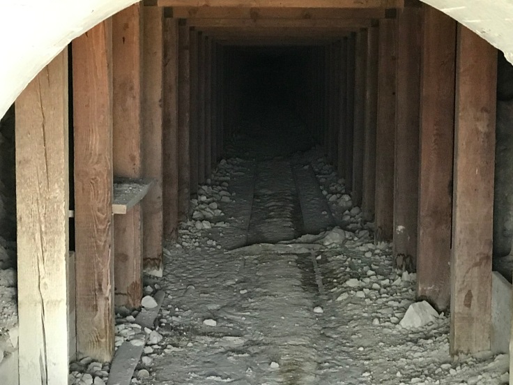
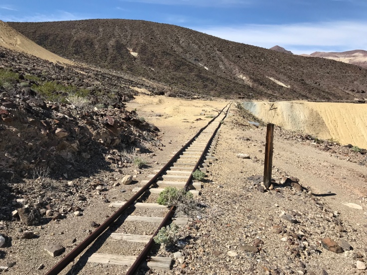
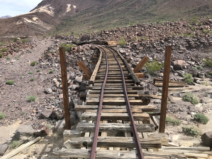
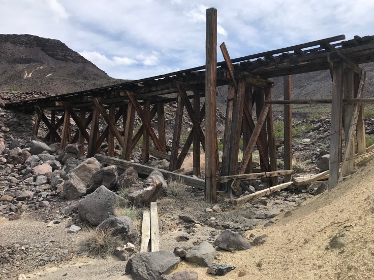
In 1914, the Death Valley Railroad started operating between Ryan, California and Death Valley Junction. It carried borax until 1928, when operations ceased. From 1923 to 1925 the Pacific Coast Borax Company constructed buildings in the town, hiring architect Alexander Hamilton McCulloch to design a Spanish Colonial Revival whistle stop centered at the hotel, theater and office complex building, now known as the Amargosa Opera House and Hotel.

The town began to decline in the mid-20th century. However, in 1967 dancer and actress Marta Becket happened to visit due to an automobile repair. She became enamored with the theater, and with help from benefactors, she leased, then purchased, the hotel and theater complex.Amargosa_Opera_House

Once you leave DV Jct. you head West into the Death Valley Nat. Park. As you drive the old railroad grade of the D.V.R.R can be seen in the desert to the left of the highway. As you drive into the narrow canyon and follow the desert wash down into the valley you can see the railroad climb above you on it way to the Ryan Camp.

Before I drove all the way below sea level and down to Furnace Creek in DV I turned off the main road onto the road that takes visitors to the park up to Dauntes overlook. Just about a mile in you can see the old camp of Ryan tucked up along the hill side above the valley. From the Ryan Camp runs an old 2ft gauge railroad track along the mountain side which accessed many different mine tunnels. From the road which follows a large wash its a strait climb up the hill to the railroad track.

IMG_8992
View looking down to the road in the valley

There is no other way up to the line but hiking strait up the hill. The hike isnt bad if you do it when its not too hot and it takes about 30min. I will say that this property is not in the National Park but is still owned by the Rio Tinto Mining company and im sure that it is trespassing, if caught.

Now to give you some back story on the Baby Gauge and its operation.

Construction began on the “ore gathering tramway” as early as December 1914, and certainly by early 1915. The route started at the DVRR ore bins, then passed over the tail track of the DVRR wye on a bridge, beneath “Poison Rock” to the Grand View Mine, about three miles. Over time it was extended first to the Lizzie J Oakley, and eventually to the Widow mine. Eventually the line reached over 5 miles in length, and as reworked and rebuilt would feature 3 long and one short tunnel as well as a number of spectacular bridges as it ran along the wall of Corkscrew Canyon.IMG_9080

By 1921, it was noted that most ore was coming from the Widow mine, with the tiny trains working hard to move the ore… “Filling ore bins of at Ryan with Widow trains is like trying to fill a bathtub with a spoon” Possibly in response a new larger Plymouth locomotive was added in 1923.

The mines at Ryan never “played out”, instead, they were replaced by a new higher grade ore body found near Boron California. Those ores were both cheaper to mine, closer to the standard gauge railroad. The line hauled its last borax ore in mid 1927, even as the line was now hauling tourists.dv-rya-44h-borax-pr-dept

Tourist service.

As mining operations were transferred to the new mines at Boron, the PCB company started to repurposed their Death Valley facilities as a tourist center. This included the purchase of gas rail cars for both the Tonopah & Tidewater and the Death Valley Railroad, and converting company housing and dormitories at Death Valley Junction, and in Furnace Creek to hotels. At Ryan the facilities were rebranded as the “Death Valley View Hotel”. The project was promoted by Union Pacific’s tourist arm.

Ryan - Frashers A1125
Death Valley View Hotel

As part of the tourist initiative, from late 1926, until an accident in 1950 (which resulted in an “expensive claim”), the Baby Gage operated as a tourist attraction. For this five flat cars were fitted with seats in late 1926. The new ride included tours of the mines. Eventually, when the mine at Boron was converged to an open pit, some of that mines equipment was moved to Ryan as displays.

Pacific Coast Borax Co, Widow Mine, Ryan, CA, Burton Frasher, 1928
Tours of the mine

After the accident the Baby Gage was left in place, only occasionally used. Today much of the railroad is in place, but unusable. The name “Baby Gauge” was coined after a little baby girl who was born at the Ryan Camp.

130623546b13c5aab9cb989005fb39d3
Tourist train on the Baby Gauge

The tracks now sit slowly washing away and being pushed around by rock slides. Overall the line is ok and the bridges look great all due to the dry climate of Death Valley. The mine sits at an elevation of 3,000ft. over looking the valley which is way below sea level. Once I made it up the the line I was near one of the large mines that had a wye track to allow trains to turn around and also near the trestle that is pictured above.

IMG_8994
switch leading into the wye track and into the mine tunnel.

The main area is the where the wye and mine tunnel is located. The tunnel is sealed off and is not able to be explored. The switch track that would have led tourists into the mine still works and can be thrown back and forth. This must have been a large mine as there are tailing piles above the mine and here at this entrance. The mountain inside must be full of shafts running up and down.

IMG_9003
Mine entrance, which is being filled in with dirt from the tailing piles above during heavy down pours.
IMG_9006
The inside of the tunnel is in great shape and you can see the track disappear into the darkness.

IMG_8998

This area has a great view of the valley below and the area is so quite as you are the only one in the area. I was able to fly my drone to get some great ariel shots of the track and trestles. I spent about two hours walking the line and exploring the area. Whats great is it is in pretty good condition and far enough away and hard to get to that most public doesn’t come up and destroy whats left.

IMG_9032
Standing just above the old trestle
IMG_9037
Half of this trestle has been back filled with waste material from the mine. You can see the timbers coming out from the pile as the dirt is washing away.

I had great weather for the hike with temps at around 80 degrees. After my hike I headed for lunch at the Furnace Creek Ranch which just saw a total remodel. Its a great place to relax and have lunch. After hiking around 3,000ft. that morning I had lunch at -282ft. below sea level.

IMG_9048
Furnace Creek Ranch

For most of my travels that day I had little to no cell service so be prepared when going to Death Valley. My hike that day was on private property so be careful if you ever plan to go up there. I left no trace and took only photos with me. The Ryan Camp is currently owned and being restored by the Death Valley Conservatory and is open for guided tours only at certain times of the year. I heard the next tour will be in October of 2019. Im sure I can go into more history but for now I think that wraps this little trip over to the Borax Works and the Baby Gauge Railroad.

Thanks for reading

A Winter Getaway to McCall Idaho

A getaway was in need for me and Christina. We have talked about going north to McCall Idaho about 95 miles due North of Boise every winter we have been together to see the snow sculptures and just get away. This past weekend before Valentines day was it. We never went before due to the roads being slick and my old Ford pick up is not good in the snow but now that I owned a Subaru Outback I felt safe and sure enough that we could make it through just about anything.

We left friday evening around 5pm making the two hour trip up the hill as the sunset. The main road, highway 55 was clear and dry but as the weekend would progress a winter storm was on its way for the area. We did see snow on the weekend but it out before it got really bad on Monday evening. As we left town we stopped for dinner at Carls Jr for some quick fast food which is always good and Christina tried out their new beyond meat burger. We took the food to go to not wast time getting up to McCall as we had booked an Air BnB to stay at and wanted to check in before it got too late.

We have stayed at an Air BnB before when we went on a trip to Olympia Washington and found it a pleasurable stay. The Air BnB we found in McCall was priced just right and we were able to get a two nights stay for the price of a one night stay barely at a hotel in town. The place we stayed at was less than a mile from downtown and surrounded by forest. the drive way was plowed out and the snow was 4ft deep all around. The room we had was nice and had a great mattress. This Air BnB was the rental of their downstairs room and bathroom. We never really saw the owners but they were very nice when we did check in.

51811948_756281824759109_1297830248020180992_n
The Air BnB we stayed at.

On Saturday we slept in and made breakfast around 10am in town. The snow had began to fall lightly and no views of Payette Lake could be seen. After breakfast we walked around town and took in the shops. The car by the way handled great on snow packed roads and it was great to have traction and stopping power. Later on Saturday we checked out the McCall Activity Barn where they have a large tubing hill and for three hour tubing rental was $18 which was not bad. By the time we were done we were tired and hungry. Before going for dinner we went back to the room and cleaned up. We had plans to have dinner at the famous Shore Lodge Hotel in McCall which has been a staple of the area since 1946.51254671_1105267296322662_5922499608985993216_n

52387524_781965948831627_7038770448259088384_n
Shore Lodge

The snow had let up for the afternoon but by the time we left dinner at 9pm the snow had begun and I could tell this was the larger of the storms predicted for the weekend. The local mountains snow pack provide the valley farmers with irrigation water all summer and without a good snow pack the farmers run dry before the season is over. So far southwestern Idaho has seen a dryer winter but recent storms have added to the pack and this latest storm was adding anywhere from 3-10 inches when all said and done.

On Sunday morning we woke up to at least 4 new inches of snow! The car was buried and the owner of the place had to call for the snow plow to come out and clear the driveway before we could leave.

52094016_321385695170252_7136069255857963008_n
Plowing out the drive way

51968861_290523484961405_3422530687947767808_n
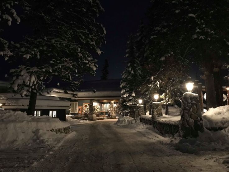
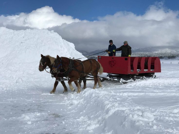
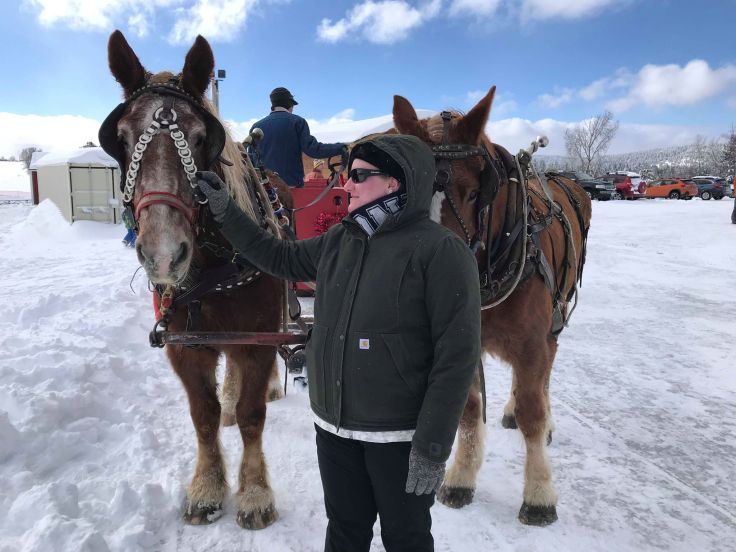
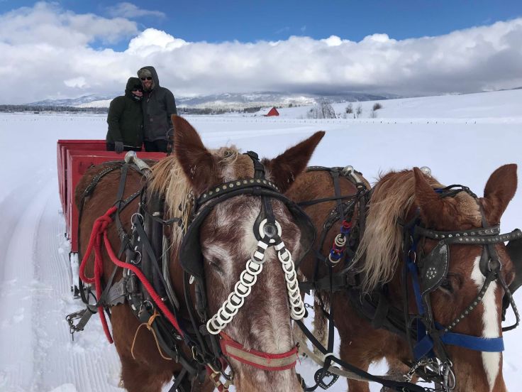
Everything looked so pretty covered in white and when the clouds parted and the sun came out everything glistened. I had planned a special surprise for Christina before we left on our trip which was a 1:30pm sleigh ride. So to kill time in the morning we walked around town in McCall and since the storm had passed the clouds lifted and you could see all the way across the lake which was totally frozen solid. Ice fishermen had set up on the lake to catch the hungry fish below. I walked out on the lake as I had never walked on a frozen lake and you know you really couldn’t tell that you were even on water. Christina watched from the shore..haha.


52407122_575455819638954_1882050979730292736_n
Standing on the frozen lake


By 1pm, we headed out to the Activity Barn which was were the sleigh ride was taking place and arrived in time to see the man bring over the large Belgium horses that were to pull the sleigh. Christina is an animal lover and horse lover and was very happy when she found out what we were doing. The ride was about an hour and pulled you along a trial through a field of snow. With the ride you get two drink tickets and could get hot coco or cider. The sleigh was equipped with blankets to keep your legs warm. It was sunny but cold with a light breeze. The temperature was hovered at 18 and with a breeze it made it feel much colder.

51899453_2270954929815531_753741042183831552_n
Our sleigh ride arriving
51849494_146712552933864_1989742293925494784_n
Christina petting the pretty horses
51783638_222429888594989_896313087164940288_n
Wonderful way to end a lovely trip together.

After the sleigh ride it was time to head home and end our winter getaway. I enjoyed our time in the snow and away from the valley and hope to do it again. Now to wait for the snow to melt and go up in the summer.

~Eriks

The Mother Road & Texas BBQ!

Wow, What a day! Dad and I got to travel the “Mother Road”, Route 66, pick up a classic railroad signal and eat at the famous Big Texan Steak Ranch. Im so full now, haha.

Pull up a chair and get ready to cruise down old Route 66 through Texas.

The day started at 8am with breakfast at the Comfort Inn and then breakfast for the Outback at Chevron. We hit I-40 East bound for Shamrock, Texas about a hour and half drive from Amarillo. As we drove I was on the

img_6448
Texaco Station in Alanreed

lookout for historic Route 66 that runs parallel to the interstate. About half way out of town I found a Route 66 brown sign on an exit sign telling me to get off here to run on the old road. From that point on we drove along 66 through small Texas towns such as Groom, Alanreed and McLean. In the town of Alanreed we found an old Texaco Station that was built in 1930. Continuing on we found lots of fields of cotton ready for cutting. I did not know that cotton was grown in Texas.

Field of cotton along Route 66

Continuing on eastward the last town before Shamrock was McLean which has the first Phillipps 66 Gas Station in Texas and boy was it small. Just take a look at the little station. The Station was built in 1929 and was the first restored station on Route 66.

Phillips Station in McLean

After McLean the next stop was Shamrock to see the famous Conoco gas station that is seen in the movie Cars as Ramon’s Body Shop this would also be the place where I would meet Jeff and pick up the Wig Wag Signal. Now Shamrock,Texas sits on the rolling plains of the eastern Texas Panhandle, along Historic U.S. Route 66 it is well known for its historic CONOCO Tower Station and U-Drop Inn Café, an iconic Art-Deco building dating back to the Great Depression, it is listed on the National Register of Historic Places. Now how did Shamrock get its name? Well an Irish immigrant and sheep rancher, George Nickel used the name Shamrock when he applied to open a post office in 1890 some 6 miles from the current town’s location. It was accepted by the postal officials but never opened. However the name lived on. Image result for Shamrock Texas
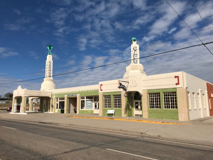
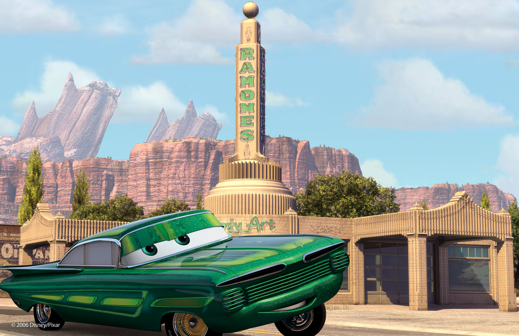
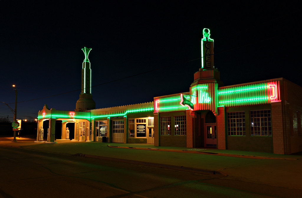
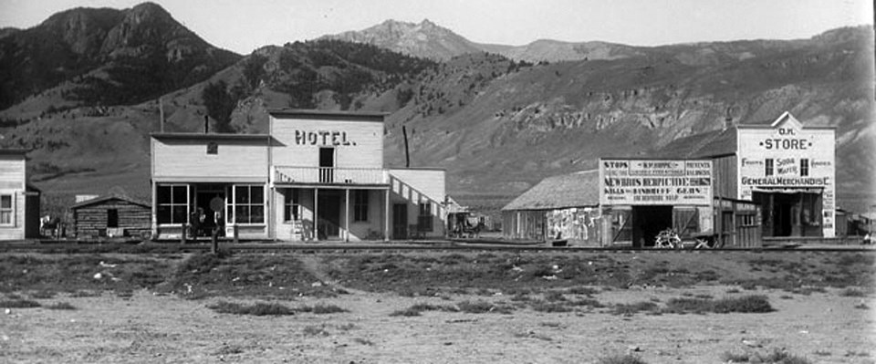
The Chicago, Rock Island and Gulf Railway reached the region in 1902 and named their stop Shamrock. A post office and a school soon opened next to it. Business followed and the town was incorporated in 1911. Oil was discovered in the area in 1925 bringing wealth and growth to Shamrock. Route 66 was the town’s main street, filled with diners, garages, filling stations and motels. Unfortunately when I-40 skipped the city center, most of these businesses closed or moved out of town, to the bypass. Natural gas, oil and cattle, and increasingly Road Trip Tourism are the main pillars of the local economy.

As we pulled into town about 30 minutes before noon when we were to meet Jeff, there it was on the main intersection in town, the Conoco Tower Station and U-Drop Inn.

U-Drop Inn cafe part of the gas station used until 1997

This station was amazing and I wish I could have stayed until night fall to take photos of the neon. Here is a day shot and a night shot that was found on line. img_6482

Related image
Pixar’s “Cars” Movie
Related image
A great night shot of the station found on line.


At noon Jeff showed up and we went back to his truck and found the signal which I was surprised at how large it was, I guess when they are mounted up on a poll they seem smaller. It took all three of us to carry it from his truck to my car. It fit just fine with room to spare in the back of the Outback.

Magnetic Flagman or Wig Wag Signal in the car ready to head back to Idaho

Once parting ways with Jeff we talked with the kind lady that worked at the gas station gift shop and yes we did buy Route 66 souvenirs, she suggested lunch at Mesquite’s hometown restaurant just north of town. After a good lunch we hit the mother road back to Amarillo and took photos and video of me driving on the original pavement.

Route 66 original pavement

Once we made it back to Amarillo we continued to follow Route 66 through downtown Amarillo and found the old main offices for the Santa Fe Railroad now a city office building and also a large antique store right along 66 which we explored for about an hour finding a perfect 1960s KFC bucket, it never even had chicken in it since there were no grease stains on the cardboard. When all said and down it was 6pm and time for dinner so we headed to the world famous Big Texan Steak Ranch!

Big Texan Steak Ranch along I-40

The Big Texan Steak Ranch is a steakhouse restaurant and motel originally opened on the previous U.S. Route 66 in the 4500 block of East Amarillo Boulevard in 1960. It relocated to its present location along Interstate 40 in 1970. Fire gutted the west wing of the restaurant in 1976 and destroyed $100,000 in antiques. The restaurant reopened as a larger facility in 1977. The building is painted a bright yellow, with blue trim. A large bull statue advertises their “free” 72 oz. steak!

Outside of the restaurant

The Big Texan is best known for its 72 ounce (4.5 pounds ) steak, nicknamed “The Texas King.” The steak is free to anyone who, in one hour or less, can eat the entire meal, consisting of the steak itself, a bread roll with butter, a baked potato, shrimp cocktail, and a salad; otherwise, the meal costs $72. Those who have successfully consumed the Texas King meal have their names recorded and posted at the restaurant. As of February 2018, over 9,500 people out of about 62,000 have accomplished this feat and tonight we got to witness two brothers from Alabama take the challenge and one of them succeed and eat it all in 45 minutes!

This is the Texas King meal

The current Champ is a woman that only weighs 120lb. and hold the fastest time. On May 26, 2014, Molly Sehuyler “Memorial Day Molly” consumed the entire meal in 4 minutes and 58 seconds and then eat another in 9 minutes 59 seconds! Check out their website: Big Texan Steak Ranch

img_6527
Inside the Steak Ranch

After a filling meal of a combo of select BBQ meats dad and I retired to the hot tub at the hotel. Tomorrow we check out one more antique shop in town and then head westward down 66 past Cadillac Ranch and out to Vega, Texas the last town we will explore before turning north for Ft. Collins, Colorado where we will be staying all day on Friday before finally turning back to Idaho and home.

Today was great and thanks to Jeff for selling his signal to us and creating this great trip for dad and I…. Remember folks, Get your kicks on Route 66! oh and your bellies full! haha

Image result for get your kicks on route 66

Texas Road Trip parts 2 & 3

So far this road trip has been exciting! In this post ill try to comprise both Monday and Tuesday adventures that were had in Leadville and then the drive down to Amarillo, Texas.

On Monday we spent the day riding the rails of the former Rio Grande Railroads, Tennessee Pass Line. The has been abandoned since 1996 or so and now lots of ATVs and hikers walk the line. Starting up at the pass we rode through a long tunnel that takes the railroad under the continental divide. We rode down grade to Red Cliff, Colorado where we went under the impressive highway bridge which is seen in the cover photo. There was snow all down the north side of the pass due to a winter storm that blew through the area late Saturday night and Sunday morning leaving the area with at least 2 to 3 inches of snow.

Tunnel portal on South side of pass.

Driving into Leadville Sunday night it was slow going with snow and ice covered roads but the Subaru handled perfectly. After the storm blew through it left the entire Rocky Mountain area in a deep freeze. Temps on Monday morning when waking up at 8 a.m. was zero degrees feeling like -7. That day the temperatures only got to the upper 20s! In total we rode 14 miles of rail one way and then picked up the rail carts at the end of the ride and drove home.

Riding through the snow covered rails.

Leadville, Colorado is a quite little rustic mining town situated at an elevation of 10,202ft. making it the highest incorporated town in North America. Leadville was founded in 1877 by mine owners Horace Tabor and August Meyer at the start of the Colorado Silver Boom. The town was built on desolate flat land below the tree line. The first miners lived in a rough tented camp near the silver deposits in California Gulch. Initially the settlement was called Slabtown but when the residents petitioned for a post office the name Leadville was chosen. By 1880 Tabor and Meyer’s new town had gas lighting, water mains and 28 miles of streets, five churches, three hospitals, six banks, and a school for 1,100 students. Many business buildings were constructed with bricks hauled in by wagons. The railroad arrived in 1880 bringing trains from Pueblo, CO. up and over the mountains to Minturn and Glenwood Springs, now along I-70. The town of Leadville also has the church where the famous “Unsinkable” Molly Brown was married in.

Image result for leadville colorado history
Downtown Leadville, Colorado

Dad and I spent two nights in Leadville and left Tuesday morning for Amarillo, TX about a 440 mile, 7 hour drive. We followed the old rail line all the way down to Pueblo through the towns of Buena Vista, Salida and Canon City. It was about a two hour drive down to Canon City which lies at the base of the Royal Gorge of the Arkansas River and is home to the Royal Gorge Scenic Train Ride. I met a friend there who works for the excursion company and he was able to show us around and give us history of the railroad. We also arrived by noon in time to see the 12:30 p.m. train leave the station.

Royal Gorge train

After parting way with my friend Nick we had lunch in downtown Canon City at Pizza Madness both enjoying two good sandwiches. We again hit the road still having roughly a five hour drive making our arrival time in Amarillo by 8:30pm. As we drove down to Pueblo we left the Rocky Mountains behind and gently the rolling hills became flatter and flatter till finally everything to the left of I-25 was totally flat as far as you could see. The last big hill we climbed was Raton Pass starting in Trinidad, CO and climbing over into New Mexico and dropping down into Raton, NM. From there we proceeded south Easternly along Route 64 to Texline, Texas crossing the border around 6pm Mountain time entering not only Texas but the Central Time Zone.

Texas State line at Texline, Texas.

The about three hour drive from New Mexico through into Texas was so flat and you could say boring with nothing to see. By the time we made it to Amarillo it was dark and around 9pm. A 440 mile trip used only half a tank of gas on the Outback! The drive felt long after getting into the flat land of Texas. We are staying at a Comfort Inn in Amarillo and tomorrow, Wednesday will be headed for Shamrock, Texas along historic Route 66 to see the famous Conoco Gas Station there and pick up the Wig Wag Signal.


Texas Road Trip part 1

Here I am on the road the again though this time I have my father with me. Today we begin our adventure to Amarillo, Texas with the ultimate eastern town for this trip being Shamrock, Texas along historic Route 66 where me and dad will be meeting a friend who has recently sold us his 1920s Automatic Flagman, wig wag crossing signal.

We decided to take a road trip instead of hassling shipping something such as this signal. So our day started at 5:30am when we hit the road in my Subaru Outback leaving Boise Idaho for Leadville, Colorado our destination for that night and all day Monday since I have a good friend who lives there and will be spending Monday exploring the area.

Dad and I are taking turns driving and as I write this he has taken the wheel and we are cursing down I-84 approaching the Utah border. Let me give you some background on what a wig wag signal is. The automatic flagman was invented by the Pacific Electric. The Pacific electric signal department decided that better grade crossing signal was needed due to the higher amount of vehicle auto traffic on the roads in Southern California. At the time of the Pacific electric was the largest inter-urban in the world spinning tracks from Los Angeles to San Bernardino down to Long Beach California. The automatic flagman is as the name suggests doing the job of the flagman who would come out from his guard shack with a red lantern and stand in the road and swing his lantern from side to side. This is what the signal does but also has a bonus of a audio warning. As the armature attached to the motor seen in the photo Below swings from side to side the red lamp is illuminated and as it swings the arm rings the bell mounted to the backside of the signal box making a dink, dink, dink sound. The PE had many of these installed on their lines and proved to be at the time quite affective. The early ones in the 1920s were built in Los Angels Ca. These signal soon spread nation wide for the first type of grade crossing signal.

The wig wag that I am picking up in Texas is just the signal box with bell and armature or banjo. I’ll be mounting this on a bracket to a telephone pole in the back yard. Not all wig wag signals had their own pole some where set on telephone poles that were next to the crossing already.

we made it to Ogden by 10:30 and had one of our favorites, In-N-Out Burger which now has locations in Utah. Of course I had the double double with animal fries and it was delicious.

After lunch we continued on our way heading for solider summit along US route 6 and down to I-70. Colorado state line was crossed around 3pm and making it to Glenwood Springs just at sunset for the area by 6pm. The Glenwood Springs area is really beautiful this time of year with all the fall colors along the river and the narrow canyon I-70 winds it’s way through Glenwood Canyon and we were very surprised to see the Colorado River bone dry for the most part. The canyon was great in the late evening light. The temperature continued to drop as we approached minturn where we got off to head for Leadville and we began to encounter snow covered roads along with ice. The last hour of driving was slow going but we made it by 7pm to our destination.

Glenwood Canyon
The road to Leadville hwy. 24

Silver City via a Model T Ford

On Sunday October 7th the Western Idaho Model T Club headed for Silver City, Idaho. This was a journey the club used to make all the time but in the past ten years it has only been a dream. The trip would make history not only because it was the first trip up the mountain for the club in over ten years but a surprise finding in Silver City would make the trip even more special. I was privileged enough to have been invited to come along with the club on this trip even though I dont own a Model T myself. In next couple paragraphs I will recount the trip and share with you lots of photos that I took of the ride.

At around 11:45 a.m. on October 7th two 1924 Model T Touring cars and one 1923 Model T speedster started out at the base of the mountain where the dirt road meets the pavement. All the T’s where trailered to this position  from Nampa, Idaho. Everyone was bundled up since the cars are not enclosed and it was a brisk morning with breezy conditions but the sun was out and crystal blue skies as far as you can see all the way up to the top of the mountains where our destination lay, the old mining town of Silver City, Idaho.

Silver City was founded in 1864 soon after silver was discovered at nearby War Eagle Mountain at an elev. 8,065 ft. The settlement grew quickly and was soon considered one of the major cities in Idaho Territory. The first daily newspaper and telegraph office in Idaho Territory were established in Silver City. The town was also among the first places in present-day Idaho to receive electric and telephone service. The town would have electricity before the capital of Idaho, Boise did.  SilverCityID.jpg

The placer and quartz vein mines became depleted around the time Idaho became a state in 1890. Due in part to its extremely remote location, Silver City began a slow decline but was never completely abandoned. Small-scale mining continued off and on until World War II; the last mine to be operated all year round in Silver City was the “Potossi,” managed by Ned Williams.

6
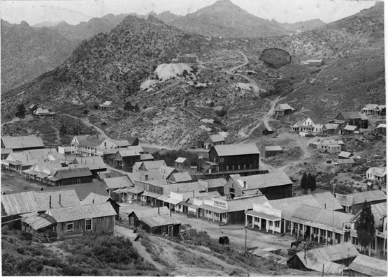
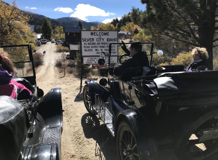
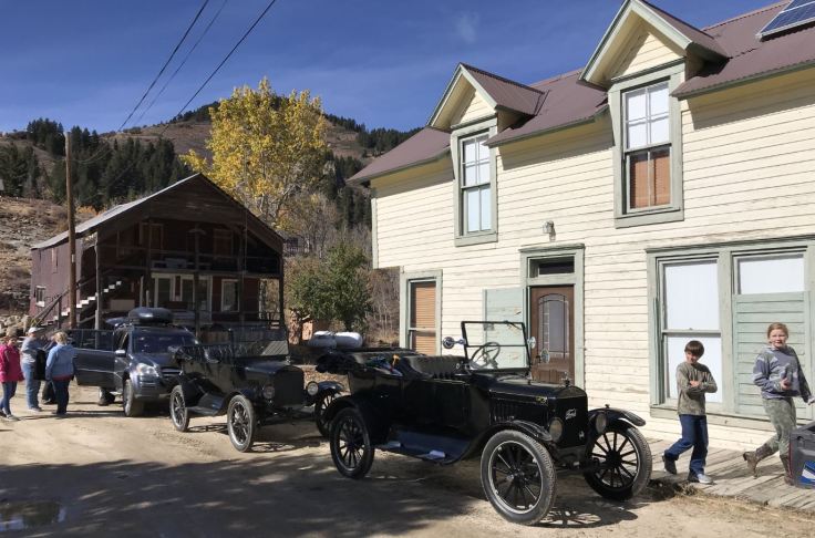
The Idaho Hotel one of the main iconic buildings in Silver City once housed 40 rooms and electric power. It was restored and re-opened for tourists in 1972. It relies today on the use of propane refrigerators and stoves in order to supply cold drinks and snacks or a complete meal to guests during the summer months. The rooms are fitted with indoor plumbing and furnished with antiques, making it a tourist destination though today there are only 13 rooms. By 1972, the townsite and its environs were listed on the National Register of Historic Places as a historic district, the Silver City Historic District.

From our starting location with the T’s to our destination is around 60 miles of dirt road. Luckily the road was in great shape but has about two large steep climbs that the group was concerned about but were all pretty sure that they T’s could make it. As we rolled along and began our accent the cars did well and there is nothing like watching the scenery roll by from the back seat of a Ford Model T.  I was in Jeremy’s 1924 Model T along with Susan and Jerry making the car fully loaded along with Mark’s tour car also fully loaded they were handling well as we climbed the first hill. Gary’s speedster with only one passenger eventually over came us and sped along the dirt road, having no problems climbing up the grade.

2
Getting closer to Silver City before the big accent. Paused for a little break and time to get a great shot of the cars together.

Following the group was a pace car and a truck and trailer just in case one of the cars broke down and had to be towed out. As we began our climb up the steepest part of the road Jeremy and Mark’s T eventually just flamed out with not enough power to climb the hill with all the weight in it. This is when Susan Jerry and I climbed out along with the other passengers in Mark’s car. After helping with a push of the T they started up the grade once again while we were left with either the pace car to ride in or on the trailer. I chose the trailer which proved to be a bumpy ride going up the hill.

The road started to level off at the top and we were able to once again ride in style to our destination. By this time the road was winding its way through the pine trees and aspens that were all in full Autumn bloom.

3

Before coming into Silver City the road drops back down into a valley and as we rode down both the Model T’s used their brakes a little much to the point you could smell the oil in the transmission starting to cook. Model T’s dont have normal brakes on the wheel area like modern cars. All the braking and clutching is done with bands on the transmission and you can over heat them if you are not careful and also destroy the band completely. By the time we rolled into to town most of the braking power was gone.

4
We Made it!

By the time we rolled into town it was just past 12:30 p.m. and decided to break out the pack lunches we all made. Town was busy with ATVs and side by sides and we found that the Idaho Hotel was still opened and was its last day of the season for them and they still had fresh baked pie to serve. Of course the whole club cleaned out what was left.

While looking around the town we met the winter caretaker. Each winter everyone leaves but one man stays and watches over all the buildings from people who come up through the snow to look at the town and may vandalize the historic structures. Now the winter caretaker happened to be Dave Wilper who was one of the founding members of the Western Model T Club! This trip to Silver City become all that more memorable and special when he gave us a tour of his home and the historic church that was built in 1868. He also showed us photos of when the club used to come up to Silver city during the 1970s.

Image may contain: 1 person
Dave Wilper holding a photo of Pete and his Model T in Silver City many years ago.
7
Our Lady of Tears Catholic Church.
8
Inside of the church with original ceiling and varnish.

After our private tour of the church it was time to head back down the hill to where we started that morning. Jeremy and Mark checked their transmissions to see how the bands had fared on the way up and down the hills and both agreed that the cars could make it back home. Once again I climbed into Jeremy’s Model T, this time just me as a passenger which helped lighten the load. Luckily we had two pilot cars for everyone to ride in to keep the weight off the T’s.  Up and down the hills we went again eventually Marks Model T lost all its braking power and he relied on low gear using the engine to brake, no tightening of the bands could help eventually and we just took it slow going back. We left Silver City around 3:30 making it back to the starting location by 5pm.

9
Leaving Silver City

In the end no cars had to be put on the trailer and everyone had a great time. The weather was perfect for the drive up to 6,210 ft. The group all decided to head for Pizza at Idaho Pizza back in Nampa where we talked about the days events and how special the day was for the group.  I myself do not own a Model T but a big 1937 school bus but the club has welcomed me in like I am part of the family. It is a great group of people and look forward to more adventures with them in the future. They all say next year they plan to ride again to Silver City and this time bring their speedsters and leave the touring cars behind. As a passenger on the trip it left me time to look out and enjoy the scenery of the trip and one could almost imagine what it was like to travel by dirt road across the great American West in an open touring car with the wind and dust in your hair. What an experience to be able to have almost 100 years later.

5
Cars up at Silver City in front of the former drug store.


One last time through the Arch of Yellowstone

Adventures in Yellowstone are coming to an end for me as my summer job comes to a close. I decided to return to the North Entrance to Yellowstone at Gardiner as I was only there once in May and early June. The weather was perfect and felt like fall, with sunny skies and puffy clouds. I wanted to see the Elk that have been hanging out in the Mammoth area and also explore the right of way that the Northern Pacific Railroad took coming into Gardiner.

16
Overlook from the old Stage Road from Mammoth to Gardiner

When I arrived into Mammoth Hot Springs area it was busy with tourists. The Park has not slowed down much even after Labor Day as the weather has been very calm and clear. I did not see any Elk when I arrived and since I had already seen the hotel and the Fort I decided to head down the hill for Gardiner and have lunch. I remembered that there is the old stage road running from Mammoth to Gardiner and that it is one way, down hill. The old road winds its way steeply down the hills toward the North Entrance.

Image result for Stagecoaches in yellowstone
Tally Ho’ Stagecoach up at the original Mammoth Hotel

It is amazing that the stage coaches used to take passengers from the depot up to the Mammoth Hotel. Not always did you make it as stagecoaches were known to flip over.

I would recommend the dirt road during the summer to anyone with a good clearance car or truck but no small cars. On the way down the road I found a nice looking Pronghorn Deer grazing in the grass and stopped to watch as it crossed right in front of me.

2
Pronghorn Deer

Once I got into town I parked the car and decided to walk around town and find a place that was not on “Main” street to have lunch. Gardiner Mt. is small town nestled between the Yellowstone River and the Park. Gardiner is famous for being the first entrance to the park and having the Roosevelt Arch, dedicated in 1916 by Teddy Roosevelt himself.

Image result for roosevelt arch yellowstone
Theodor Roosevelt dedicating the Arch in 1916.

I found lunch down at the end of town against the Yellowstone River at a place called the Iron Horse Bar and Grill. The place had a great feel to it with all the cool vintage signs hanging on the outside and inside of the place. They had the simple tavern food and I decided to have an Elk Burger, not bad different than a bison burger.

3
Iron Horse Bar and Grill
4
Inside the Grill

After having a filling lunch I headed out down the old Gardiner road which is part old dirt road town before new highway and part old Northern Pacific Main line into Gardiner. The rail ran out to Gardiner area starting in 1883 and terminated at a place called Cinnabar which is only three miles north west from Gardiner. The reason for the line ending here was due to a miner not wanting to give up his rights to the land for the railroad which kept the line from going all the way into Gardiner for 19 years. Today nothing remains of the train or the town of Cinnabar Mt.

Image result for northern pacific to cinnabar
NP train at Cinnabar, MT.
Image result for northern pacific to cinnabar
The happening town of Cinnabar, MT.

About ten miles north of town the dirt road that had been following the old NP right of way merges with the with the right of way and you are driving where the tracks used to be. The valley comes together into a tight canyon where both sides of the mountains have been carved out by the Yellowstone River. The area is called Yankee Jim Canyon and the road ends here and no cars can proceed any further. I decided to walk the remainder of the way along the old right of way.

5
Driving the old rail bed of the Northern Pacific
6
Only remaining railroad ties on the right of way. Be careful or you will drive right over and miss it!

While exploring this area I noticed right above the railroad ROW was rock walls like from an old road. I discovered that the old road to Gardiner was just about the size of a stage road and found old cans and broken glass along the edge of the road, a unique find. 7

I headed back in town as the sun was beginning to set and since Mammoth Hotel was just up the hill from town I drove back and had dinner at the dinning hall. Since it was now evening the Elk had come down to graze in the grassy areas around the buildings. Dinner was nice in the dining room and even though it is in the fancy dining room every meal I had out this trip all cost the same it didnt matter if I was in town or in Yellowstone.

18
Male bull Elk resting in the shade at Mammoth

I spent the night down in Gardiner and the next morning I woke up early as it was down right freezing in the car. I was able to catch the sunrise at the Roosevelt Arch and have breakfast. I had a special tour of the garage building where all the historic stagecoaches and buses that once traveled through the park. The tour was given by an employee of the Yellowstone Park Archive building. The archives has the history from day one of the park. The garage has a great collection and will have to do a post about  the vehicles that I saw. That afternoon I headed back home and had lunch up at the Mammoth Cafe and got to see more Elk grazing the area. Overall the weekend was a nice get away with great September weather. Ill miss being able to go around the park on my days off.

8
Inside of the garage with the historic equipment.

The forbidding Beartooth Mountains and my trip to Billings, Mt.

My last weekend I headed through Yellowstone Park for the northeast entrance and the Beartooth Mountains where the road climbs up over the pass at 10,974ft. The trip which was round trip at 450 miles since I decided to go as far as Billings Mt. I saw so much and will try to get most of what I saw out. I have included lots of photos since there is no good way to describe the view from almost 11,000ft.

I left early from West Yellowstone my destination for the night was Red Lodge, Montana about a 4 hour drive. On the way through the park I was able to see two grizzly bears foraging in the meadow and also two buffalo going head to head in a fight. The Lamar valley this time of year has turned yellow from the trees to the grasses.  It sure felt like autumn as grey clouds and rain moved through the area of Cook City which is just outside of the Northeast entrance to Yellowstone.

1
The Lamar Valley looking East toward Cook City and the Beartooth Mountains.

Starting in Cook City is the famous Beartooth Highway which takes you over the Beartooth range. The drive was very scenic and quite cold at the top of the pass the day I visited was only 37 and windy. Make sure to pack jackets when traveling over the pass no matter what time you visit as snow can be found year round at the pass. Also if you are not use to high elevation take it easy as the air is quite thin up at 10,000ft. The photos below show what it is like up at the top. After cresting 9,000ft. all trees and shrubs fade away and you are left with a tundra like environment of small grasses only.

3
View from 10,974ft. up looking south west to Yellowstone
2
If you look toward the road in the bottom left you can see my car. I hiked up to a large pile of snow. Its not easy hiking at almost 11,000ft.

Once zig-zagging my way down the mountain I found myself in beautiful Red Lodge, Mt. and temperatures around 65! Once grabbing lunch I explored town and found lots of historic homes and the place where the Yellowstone Bus Preservation group is turning an old gas station garage into a museum and showroom for the historic Yellowstone Park Buses. Also in town is a small museum that talks about the town history and how Red Lodge was famous for its extensive coal mines. The Northern Pacific Railroad not only hauled out the coal but also was the main company to use the coal for their steam engines.

5
Northern Pacific Depot in Red Lodge

The area of Red lodge begins with the United States government signing a treaty with the Crow Nation, ceding the area which now contains Red Lodge, MT to the Crow Indians. Rich coal deposits were found soon after and another treaty in 1880 allowed the area to be settled starting April 11, 1882.

A rail line was constructed into town, and coal shipments began in June 1889. The boundaries of the Crow Reservation were redrawn in 1892, opening the whole area to settlement. From then until the 1930s, coal mining defined the town.

7
coal line in Red Lodge

By  the late 19th century, many new settlers came to Red Lodge, MT. from around the world. By the mid-1880s, migrants were still outnumbered by large numbers of Native Americans. By 1892 the population reached 1,180.


Image result for history of red lodge mt
Billings Ave., Red Lodge Mt.

In 1896, Red Lodge had twenty saloons and, as the library records show, riotous and violent living was characteristic of the town. By 1906 the population had grown to 4,000 and by 1911 this had increased to 5,000.

By 1931, work began on the Beartooth Highway linking Red Lodge to Yellowstone National Park.

Image result for beartooth highway construction
Workers taking a lunch break

The highway was constructed by Morrison Knudsen out of Boise, Idaho. The road took five years to build and it officially opened in 1936. From then on Red Lodge developed as a tourist industry town as open pit mining took hold in Montana closing all the underground mining.


A friend of mine could not meet me in Red Lodge but he lives in Billings, Mt. which from where I was is only a 1 hour drive north. The drive to Billings takes you along farm land and couple more small towns. I arrived in time to have dinner with him and was surprised at how large Billings is. I was able to spend the night with him and would have some time in the morning to explore town before having to head back home.

11
Old downtown Billings

Billings is situated on the north side of the Yellowstone River and named after Frederick Billings, Billings was born in 1882 as a rail hub. It was first founded by the Northern Pacific Railroad on a site originally known as Clark’s Fork Bottom. Montana Avenue sprang to life along the railroad. 
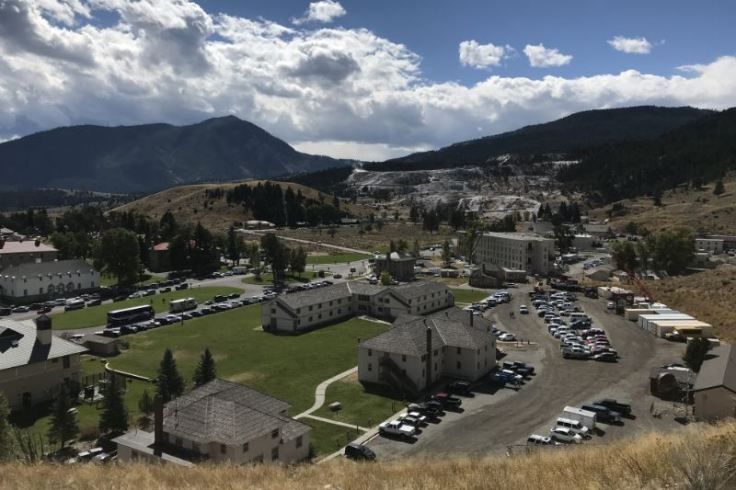
The railroad was the heartbeat of Billings as it grew. The Northern Pacific, Great Northern, Chicago, and Burlington & Quincy railroad companies made regular stops on Montana Avenue.  I explored Montana Ave. and the old Northern Pacific Depot which is currently an event center and hosts many weddings in the baggage side of the building.

13
outside of NP Depot in Billings

The depot was built in 1909 for use by three railroad companies: Northern Pacific, Great Northern, and Chicago, Burlington and Quincy. Designed in the Beaux Arts Eclectic style, the four original buildings included the main depot building, railroad lunch room, postal building and an office building.

15
Depot Waiting Room

The depot building was designed by the Northern Pacific Railroad’s chief engineer and featured a spacious waiting area for 200 passengers, a gentlemen’s smoking room, a ladies’ waiting room, a baggage area and service offices. These buildings are the center of Billings’ town site district, which was placed on the National Register of Historic Places in 1978.


However, the train era eventually faded with the ease and speed of highway and airway travel. The last regular Amtrak passenger train left the Depot eastbound in the spring of 1979. The demise of rail travel left many of the early twentieth century buildings in the Depot area vacant and deteriorating. Starting in 1995 restoration began and by 2001 the depot was ready for its first event.

The trip back to West Yellowstone would take me back over the Pass and through Cook City. I stopped on the way and checked out Lake Creek that flows along the roadside before going back into the park which had many trees all turning yellow.

16
Lake Creek flowing east
18
Lake Creek looking up river to Pilot knob

The park was still quite busy so getting back took time with the traffic but was still able to get into town by 5pm after leaving Cook city at 2pm. Overall the trip was great and being able to meet up with my friend and stay over at his house instead of sleeping in the car made the extra 68 miles to Billings worth it along with seeing the town.

MOR to Discover at the Museum of the Rockies

From dinosaurs to homesteading and lots in between, the Museum of the Rockies offers a an inside look at Montana geologic past along with its pioneering roots.

I took my last trip to Bozeman, Montana yesterday as I am now one month from going home and my summer job ending here in West Yellowstone. After all the trips that I did make to Bozeman I had not yet visited the Museum of the Rockies. I can say that I had a nice time down in the valley and back into summer with temperatures reaching 81 compared to the fall like weather of 70 in West Yellowstone. Up here all the willows and aspen trees have turned yellow and Autumn has arrived for sure.

The hour and 20 minute drive down the hill was uneventful besides seeing the fire that has been slowly burning along the hill side since July 20th of this year. The smoke comes and goes form the Yellowstone valley making tourists complain. When I arrived at the museum I was just in time for the 11am showing of “The Mystery of Dark Matter” playing in the planetarium. The 30 min. show was nice and relaxing. The planetarium also shows “Whats up with the night sky” which talks about what is currently in the sky at night and what to look out for.

After taking in Dark Matter I headed into the museum and their current display on the history of the Guitar. m1 
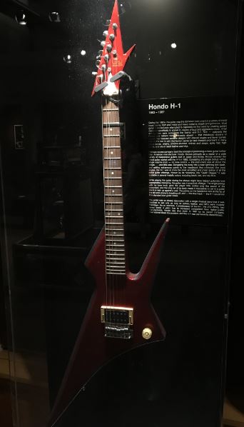
In the hall they had all kinds of guitars and even as they say the largest playable guitar in the world. I felt like I was at the Hard Rock Cafe.

m2
Hondo H-1 Guitar

They even had a fun display about the history of the “air guitar”. It was just an empty display case but what I found out is that there is a contest in Europe that judges the best air guitarist.

m8

The museum is known for its large displays of dinosaur fossils and the larges T-Rex skull in the world along with displays on geologic time and triceratops skull from birth to old age. Its amazing how large they get. m7

m6
T-Rex skulls, some of the largest in the world.

As you wander through time you end up coming into a small display on Native Americans and then in to Montana’s pioneering and early statehood displays.

m5
Display of Montana’s history

The displays range from mining to military to a mail order airplane. Yep at one time you could order one in the mail and as you can imagine some assembly required. The plane came with a Ford Model T engine and the one in the photo above shows a mail order plane that did fly. Also just below the plane is a representation of an old Montana gas station that once sat along the early dirt highways of the state. A cute sign hangs on the front porch which reads……m9

Another interesting find was a small tin can that was used to store condoms in. I guess back in the day condoms were reusable. Back when the tin was used latex didnt exist so from what I can remember from past history I have stumbled upon is that condoms were made from somewhat of the same material as sausage casing.

m4
Condom tin

Overall the museum took about half a day to walk through and im sure could take more than a day if you really look and watch everything. During the summer there is even a living history farm just next door to the museum that has an old farm hour dating to the 1890s and a blacksmith shop.

If you in the Bozeman area and have time make sure to stop and see a T-Rex dinosaur and a mail order airplane.

Create a free website or blog at WordPress.com.

Up ↑

Design a site like this with WordPress.com
Get started